Computer map technology continues to transform how people in the United States interact with their surroundings. These digital maps, far beyond simple directions, now integrate artificial intelligence and augmented reality to provide dynamic, personalized, and highly accurate information. From predicting traffic patterns to visualizing smart city data in real time, computer maps are becoming essential tools for daily life, travel, and even critical infrastructure management across the USA. They offer an immersive experience, helping us explore new places virtually or navigate complex indoor spaces with unprecedented ease. This evolving landscape is shaping everything from personal commutes to large-scale urban planning, making our world more navigable and interconnected than ever before. We are constantly seeing new innovations, keeping the American public highly engaged with these evolving mapping solutions.
What is a computer map?
A computer map is a digital representation of geographic data. It is viewed and interacted with on a screen. These maps use software to display locations, routes, and points of interest. They offer dynamic features like zooming, panning, and real-time updates. This technology has replaced traditional paper maps for most uses.
How do computer maps work?
Computer maps gather data from satellites, GPS, and sensors. This information is then processed by algorithms. These algorithms render visual representations on a digital screen. They continuously update to reflect real-time changes, offering accurate and current navigation. This complex system ensures precise location tracking.
What are the main benefits of using a computer map?
Using a computer map offers immense benefits. You get real-time traffic updates, precise turn-by-turn directions, and the ability to find points of interest instantly. They enhance safety, save time, and provide flexible routing options. These maps make travel planning much more efficient and less stressful.
What are the different types of computer maps available?
Many types of computer maps exist, each serving unique purposes. There are street maps for navigation, topographic maps for terrain, satellite maps for aerial views, and specialized GIS maps for analysis. These variations cater to diverse needs from daily commutes to scientific research. Each type offers distinct visual and data layers.
Who developed the first modern computer mapping system?
While mapping has ancient roots, modern computer mapping as we know it began evolving significantly in the mid-20th century. Companies like RAND Corporation contributed early GIS concepts. However, widespread public use truly accelerated with advancements from tech giants and startups, making digital navigation accessible to everyone.
How does augmented reality enhance a computer map?
Augmented reality (AR) significantly enhances a computer map by overlaying digital information onto your real-world view. Imagine seeing directions directly on the street through your phone camera. This provides immersive navigation, easier landmark identification, and a more intuitive understanding of your surroundings, making exploration effortless.
Can computer maps help with urban planning?
Absolutely, computer maps are invaluable for urban planning. They allow planners to visualize demographic data, infrastructure, and environmental factors in rich detail. This helps them make informed decisions about zoning, traffic flow, and public services. These tools are essential for creating more efficient and sustainable cities.
Have you ever wondered how computer map technology constantly improves your daily life in the United States? It is an incredible journey. Computer maps are digital representations of geographical areas. They are created, managed, and displayed using computer software. These maps are everywhere, guiding our commutes, helping us discover new places, and even assisting critical emergency services. They leverage vast amounts of data and advanced algorithms to offer dynamic and interactive experiences. Today, computer maps are not just about showing us where to go; they actively anticipate our needs and provide intelligent solutions, making our interactions with the world seamless and efficient.
The Evolution of Computer Map Technology in the USA
The journey of the computer map in the United States began with simple digital displays. Today, these maps are sophisticated intelligence systems. They combine satellite imagery, GPS data, and real-time sensor information. This evolution has transformed how we perceive and interact with geography. Early digital maps were static and offered limited functionality. Modern computer maps are dynamic, interactive, and personalized, adapting to individual user needs. They represent a significant leap forward in digital spatial understanding.
From Paper to Pixel: A Brief History of Computer Map Innovation
Remember folding large paper maps in your car? The shift to the computer map changed everything. This transition brought incredible convenience and accuracy. Early innovations involved digitizing existing paper maps for basic viewing on computers. As technology advanced, the introduction of the internet and GPS revolutionized their capabilities. This allowed for real-time positioning and dynamic routing. The growth of mobile devices further pushed these maps into everyone's pocket. It transformed personal navigation forever.
AI and the Future of Computer Map Navigation
Artificial intelligence is redefining the computer map experience. It makes navigation smarter and more intuitive. AI algorithms analyze traffic, weather, and even user preferences. This helps predict optimal routes and travel times with remarkable accuracy. Imagine a computer map suggesting a new shortcut based on live road conditions. It learns your driving habits, helping you avoid congestion before it even begins. This AI integration promises a future of truly proactive and personalized navigation for all.
| Feature of Computer Map | Description | Benefit |
|---|---|---|
| Real-time Traffic | Live updates on road conditions and congestion. | Avoid delays, save time. |
| 3D City Models | Detailed, interactive three-dimensional representations. | Enhanced navigation, better spatial understanding. |
| Augmented Reality (AR) | Overlaying digital information onto the real world view. | Immersive directions, easier landmark identification. |
| Voice Guidance | Spoken turn-by-turn directions. | Hands-free navigation, improved safety. |
| POI Search | Discovering points of interest like restaurants or gas stations. | Convenience, efficient trip planning. |
| Offline Access | Using maps without an internet connection. | Reliable navigation in remote areas. |
| Personalized Routes | Tailored routes based on user preferences and history. | Optimized travel, time efficiency. |
What Others Are Asking?
What is a computer map?
A computer map is a digital representation of geographic data. It is viewed and interacted with on a screen. These maps use software to display locations, routes, and points of interest. They offer dynamic features like zooming, panning, and real-time updates. This technology has replaced traditional paper maps for most uses.
How do computer maps work?
Computer maps gather data from satellites, GPS, and sensors. This information is then processed by algorithms. These algorithms render visual representations on a digital screen. They continuously update to reflect real-time changes, offering accurate and current navigation. This complex system ensures precise location tracking.
What are the main benefits of using a computer map?
Using a computer map offers immense benefits. You get real-time traffic updates, precise turn-by-turn directions, and the ability to find points of interest instantly. They enhance safety, save time, and provide flexible routing options. These maps make travel planning much more efficient and less stressful.
What are the different types of computer maps available?
Many types of computer maps exist, each serving unique purposes. There are street maps for navigation, topographic maps for terrain, satellite maps for aerial views, and specialized GIS maps for analysis. These variations cater to diverse needs from daily commutes to scientific research. Each type offers distinct visual and data layers.
Who developed the first modern computer mapping system?
While mapping has ancient roots, modern computer mapping as we know it began evolving significantly in the mid-20th century. Companies like RAND Corporation contributed early GIS concepts. However, widespread public use truly accelerated with advancements from tech giants and startups, making digital navigation accessible to everyone.
FAQ
What is a computer map and why is it important?
A computer map is a digital geographic visualization tool. It is crucial for navigation, urban planning, and resource management. These maps provide real-time data and interactive features. They help users understand and interact with their physical environment efficiently.
Who uses computer map technology?
Everyone from everyday commuters to specialized professionals uses computer map technology. Drivers rely on it for navigation, businesses for logistics, and governments for planning. It's an indispensable tool for anyone needing location-based information, making daily tasks easier.
How do computer maps impact our daily lives in the USA?
Computer maps profoundly impact daily life in the USA. They guide our travel, help us find local businesses, and inform public services. They streamline commutes and enhance safety on the roads. These tools are integral to personal and professional activities across the nation.
When did computer map technology become widespread?
Computer map technology became widespread in the early 2000s. This was thanks to internet growth, GPS integration, and mobile device proliferation. Services like Google Maps pushed it into mainstream use. This era marked a significant shift from traditional paper maps to digital solutions.
What is the future potential of computer map applications?
The future potential of computer map applications is vast. It includes advanced AI for predictive navigation, immersive AR for urban exploration, and seamless integration with autonomous vehicles. Expect more personalized, proactive, and interconnected mapping experiences. These will continuously redefine how we move and interact.
AI powered routes, AR navigation, Real time data, 3D city models, Personalized experiences, Environmental insights with computer map.
35




2026 World Map With Country Names Stable Diffusion Online 13616905 6b41 48fd A090 . Interactive Map Year 2026 R . Clevo Intel Roadmap . Risk Map 2026 Global Travel Risks And Safety Trends Travel Outlook Is Risklines Monthly Update Key Travel Trends Emerging Risks And Important Events That May Impact Global Mobility. From Political Instability And Natural Disasters To . Technology Of The Future A Computer Chip Illuminates The Year 2026 On A Technology Future Computer Chip Illuminates Year Circuit Board Generated Ai 345878049


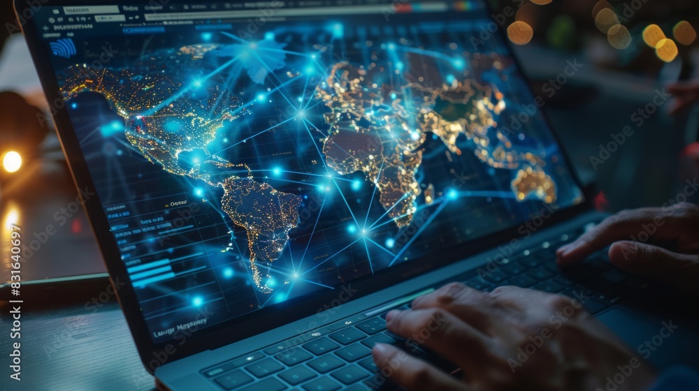


Map Of The World In 2026 In My Parallel Universe By Map Of The World In 2026 In My Parallel Universe By Dgcslsz Pre . 2026 Computer Mainboard As New Year Celebration With 1000 F 1655922366 . Digital Map On The Laptop Screen The Focus Is On Details 1000 F 831640697 . Year 2026 Digitally Displayed On Abstract Technology Background Year Digitally Displayed Abstract Technology Background Future Innovation 345238471 . Download 3d 2026 Digits 4k 2026 Concepts Red Technology Background Thumb2 3d 2026 Digits 4k 2026 Concepts Red Technology Background 2026 New Year
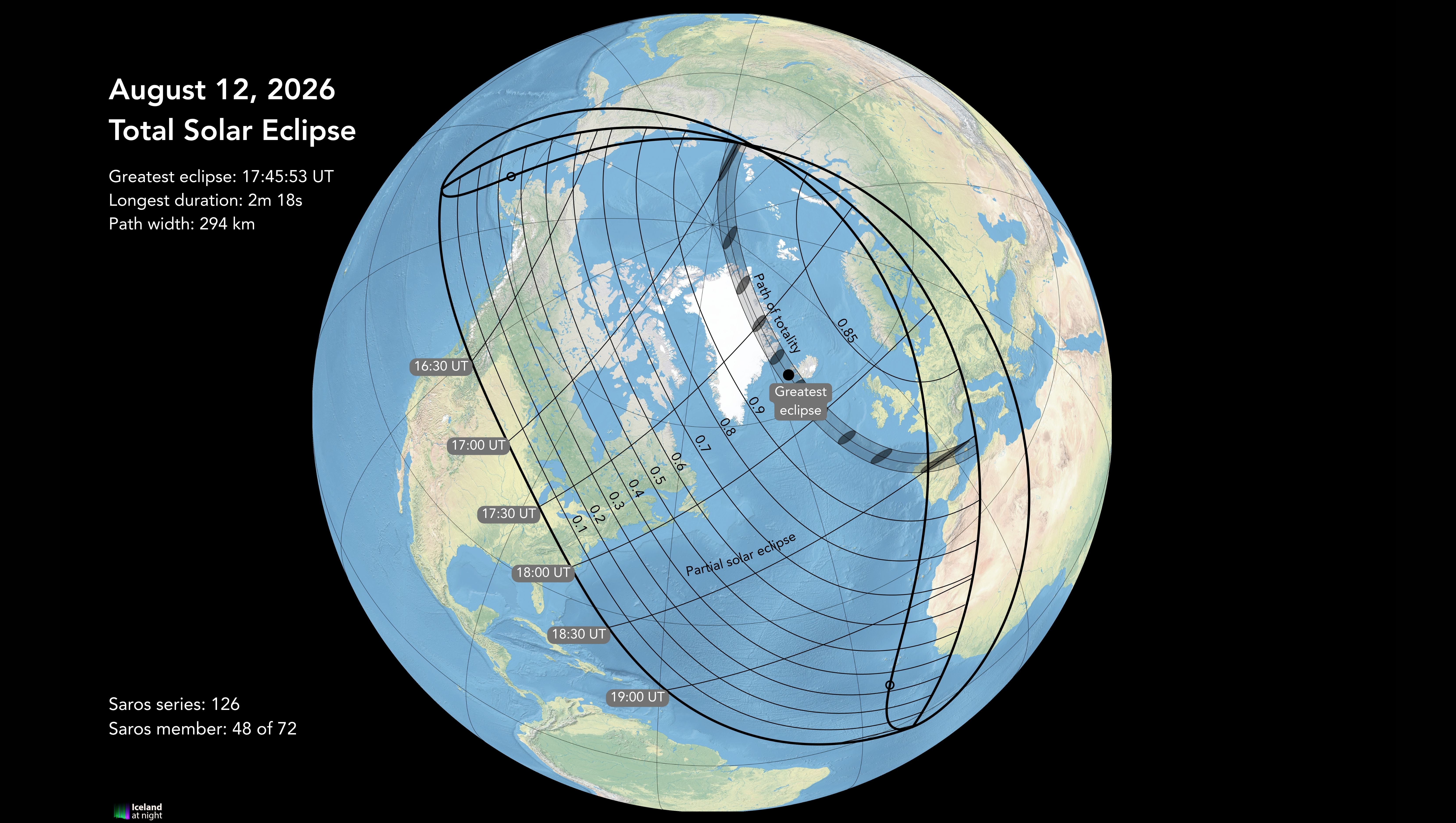



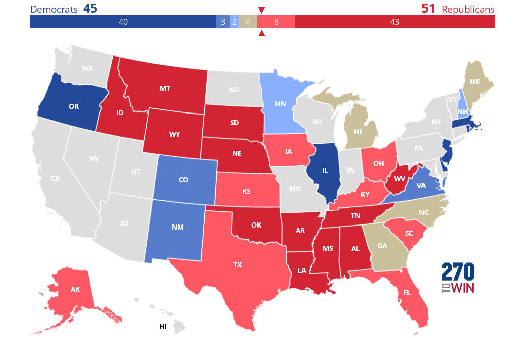
Maps Of Iceland For The 2026 Total Solar Eclipse Eclipse 2026 CM 9 . Top Computer Vision Conferences USA 2026 AI Events Computer Vision Conferences In USA 2026. Taking A Look At The 2026 Senate Map YouTube . Ranking Roadmaps 2025 Edition The Ancient Gaming Noob . Introducing The 2026 Senate Interactive Map 270toWin Preliminary 2026 Senate Outlook


2026 On Computer Chip Symbolizing Future Technology And Innovation Computer Chip Symbolizing Future Technology Innovation Circuit Board Background 351909092 . Close Up View Of A Futuristic 2026 Computer Chip Close Up View Futuristic Computer Chip Technology 347119097 . Introducing The 2026 Senate Interactive Map 270toWin Senate Incumbent . Multimodal AI Computers That See Hear Think Like Humans Generative AI . 2025 Vs 2026 MacBook Pro Comparing The Upcoming M5 And M6 Models 2026 MacBook Pro Rumors 1024x538


2026 Census Test 2026CT National Sites Map Large . Call Of Duty League 2026 Maps And Modes Revealed Insider Gaming Call Of Duty League 2026 . GATE 2026 Preparation Strategy GATE 2026 Strategy GATE 2026 . Map Of Computer Science R Compsci . A Glowing Roadmap Features Milestones Labeled 2026 And Beyond A Glowing Roadmap Features Milestones Labeled 2026 And Beyond Future Planning And Strategic Roadmap Development Set 5 Vector





2026 House Election Interactive Map 270toWin MmxBNwq . The DLCC Target Map 2026 Democratic Legislative Campaign Committee 2026 Expanded Target Map Web Inline 1024x538 . Where Is The 2026 World Cup Cities List Worldcup Eng . When Are The 2026 Elections . ICSE Class 10 Computer 1 Pager Notes Memory Maps 43e201





Strategy 2026 A Roadmap To The Future YouTube . T L Charger 3d 2026 Chiffres En Argent Contexte De La Technologie Thumb 3d 2026 Silver Digits Black Technology Background 2026 Concepts Happy New Year 2026 . Introducing The 2026 Senate Interactive Map 270toWin Blank 2026 Senate Map . 2026 On An Empty Solid Background With Bright Blue Color In A 1000 F 858507284 . T L Charger 2026 Nouvel An 4k 3d 2026 Chiffres Contexte De La Thumb2 2026 New Year 4k 3d 2026 Digits Blue Technology Background 2026 Technology Background